Last September 18 – October 1, 2019, two Nakamura Lab members, Ayin Tamondong and Yuki Kobayashi, went to the Philippines to participate in a workshop and do field survey activities. They attended a 1-day workshop entitled “Zero-Cost Remote Sensing Approach” given by Dr. Kazuyo Hirose, Director-General of Japan Space Systems, at the University of the Philippines, Diliman, Quezon City on September 19, 2019. They learned to use alternative equipment such as mobile phones for field survey activities. They also explored freely available satellite data which can be easily downloaded from the internet and also learned to use open source image processing software.
Participants of the “Zero-Cost Remote Sensing Workshop” with Dr. Kazuyo Hirose
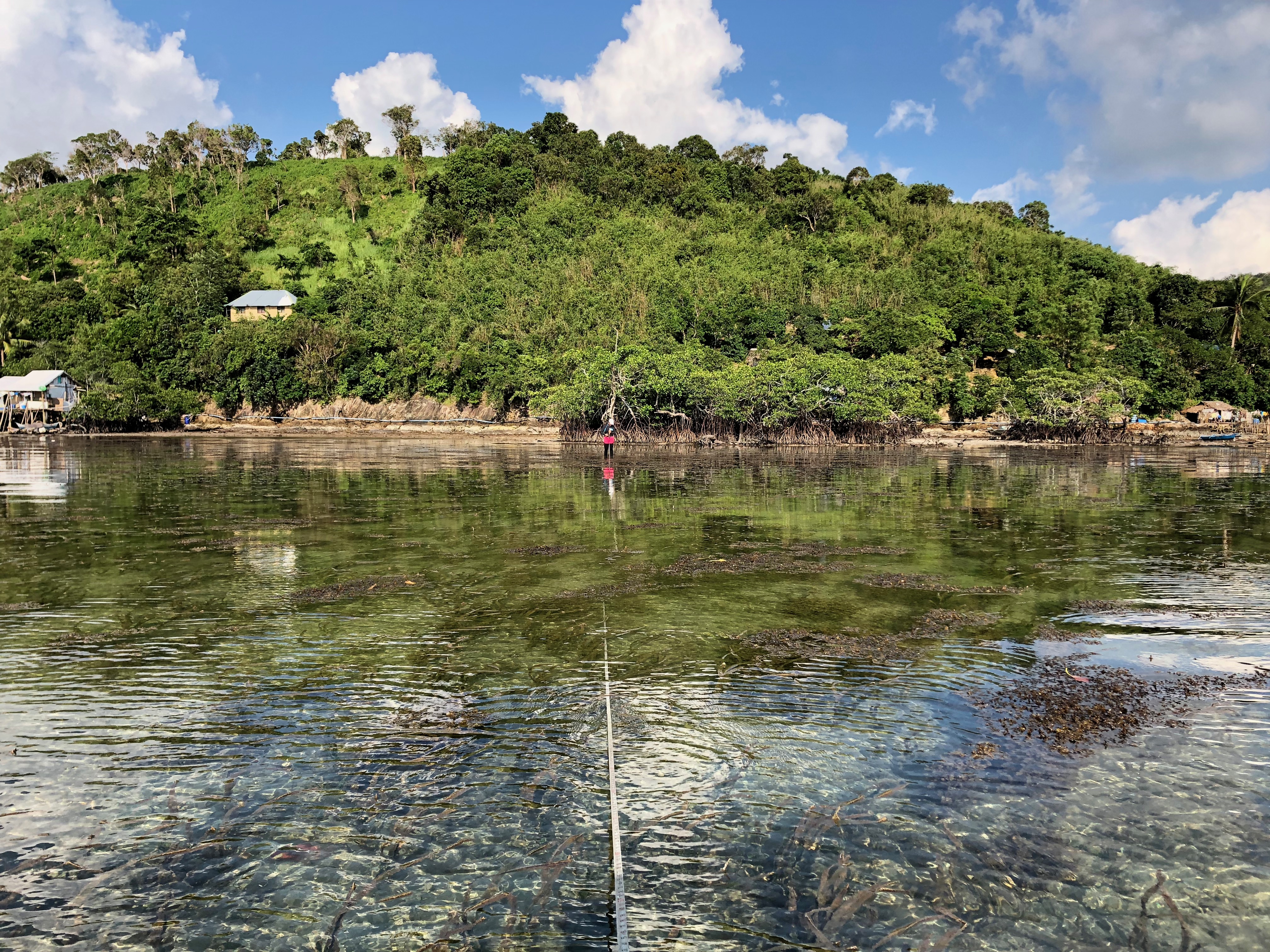
On September 20, 2019, they flew to Busuanga Island, Palawan, Philippines to conduct field survey activities. The objectives of their field survey were to gather water quality parameters, drone images and seagrass measurements for developing a methodology to improve mapping of seagrass in turbid waters using remotely sensed data, to compare and contrast seagrass health between locations with good and turbid water quality and to assess the hydrographic and transport conditions in the seagrass meadows in Concepcion, Busuanga. To assess the water quality of the study area, they used the AAQ Rinko Multi-Parameter Water Quality Profiler while a DJI Phantom 4 Pro was utilized for automated flight surveys of seagrass meadows. Moreover, seagrass surveys were done in four (4) stations in the study area with each site varying in water quality conditions. And lastly, sensors such as water level logger, turbidity chlorophyll meter (compact CLW) and 2-D electro-magnetic current meter (Infinity-EM) were deployed in three (3) strategic stations to assess the hydrographic and transport conditions of river plumes along the seagrass beds of the study area.
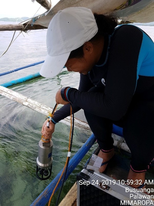
Ayin Tamondong measuring the water quality using the AAQ Rinko multi-parameter profiler
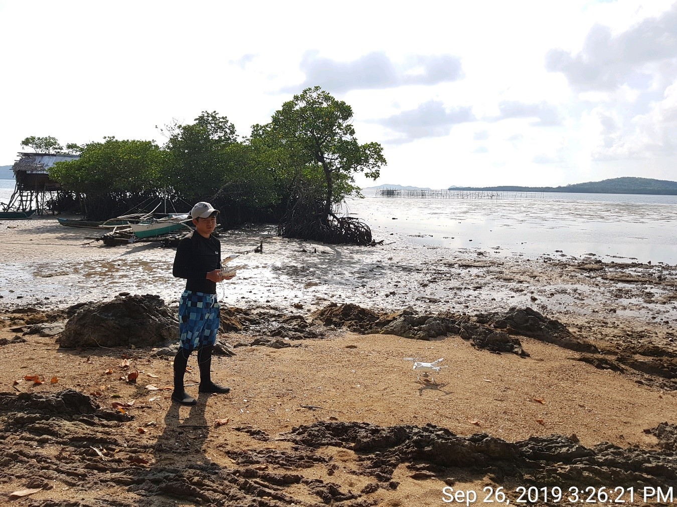
Yuki Kobayashi operating the DJI Phantom 4 Pro for seagrass mapping
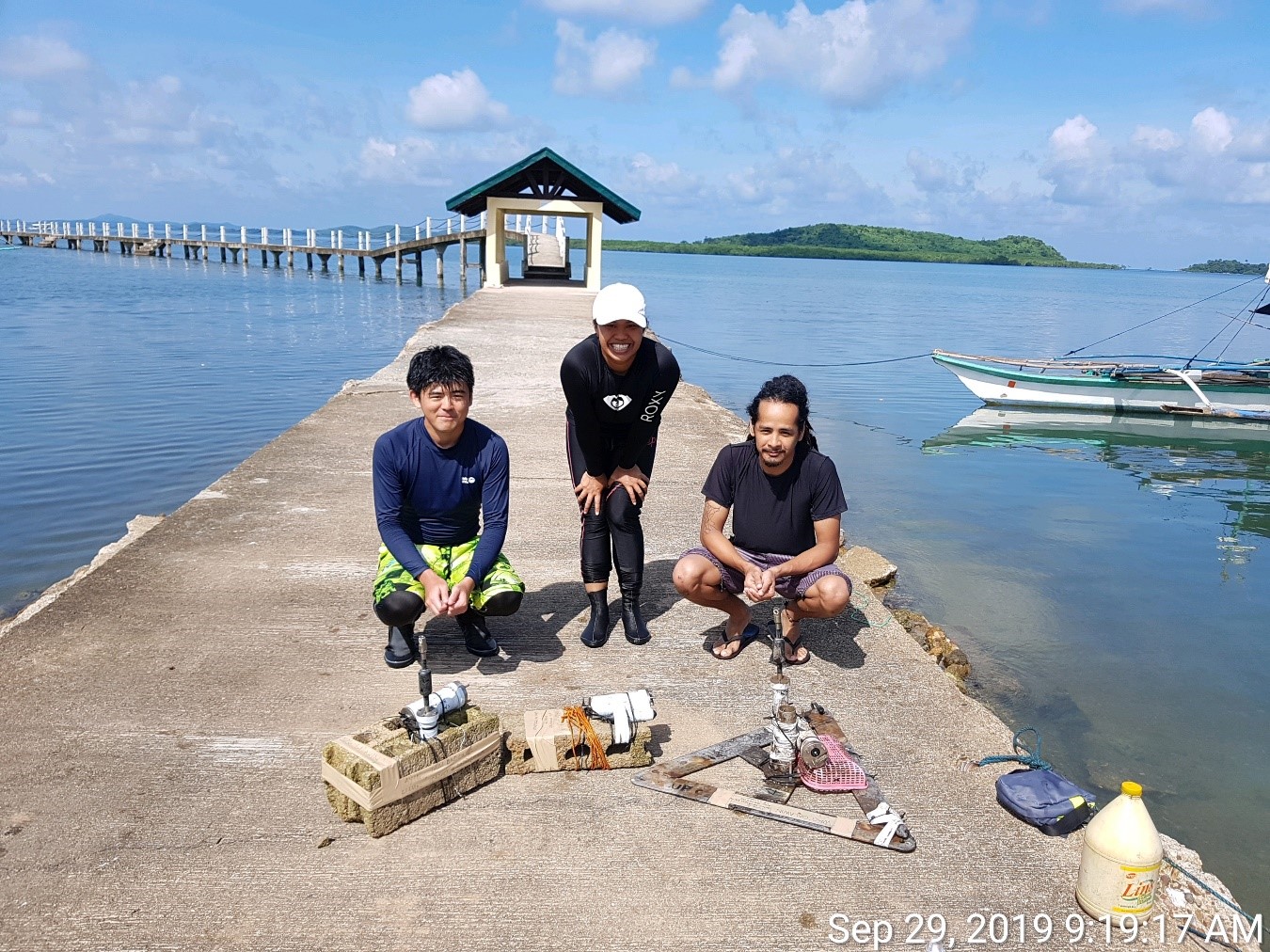
(from left to right) Yuki Kobayashi, Ayin Tamondong and Mikko Garcia (researcher from the Philippines) after successfully retrieving all deployed sensors
こんにちは!今年度から中村研に所属している融合理工学系B4の小林です。
上に英語でも書いてあるように、今回私たちは海草藻場のリモートセンシングに関わるデータを手に入れるため、フィリピンのブスアンガ島というところで現地調査をしてきました!
この記事では、私たちの調査の様子を簡単に紹介したいと思います。
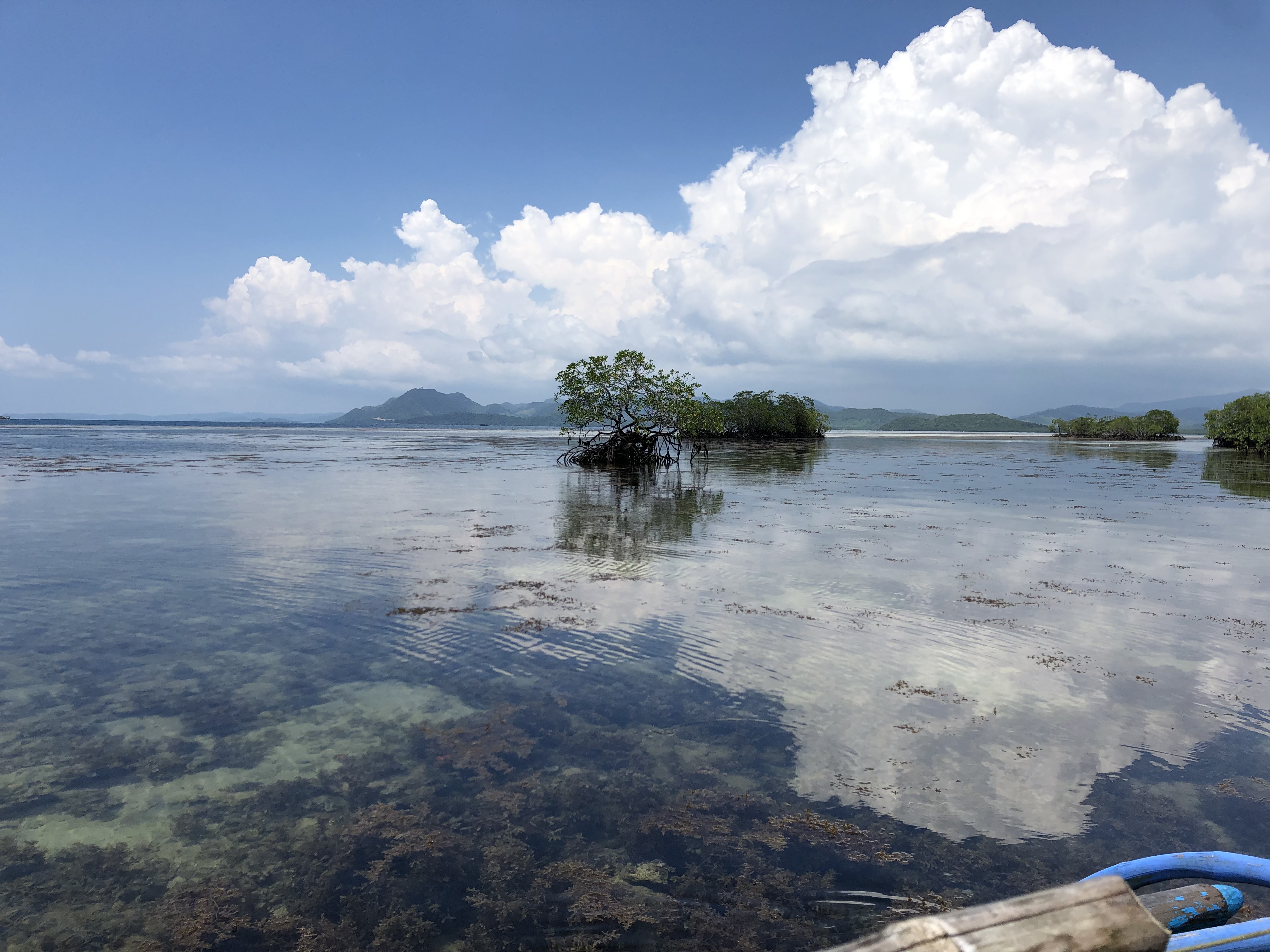
リモートセンシング(略してリモセン)は、私たちの分野では人工衛星やドローンから得られた画像などのデータを使って、浅海域の生態系を文字通り「離れたところから測る」ことをいいます。ふつうの海岸では海が濁っていたり深すぎたりして海底の様子を見ることは難しいのですが、今回調査したブスアンガや中村研でよく調査されている石垣島などでは、下の写真のように海がとてもきれいでしかも遠浅な地形なので、上空から広範囲の海底を撮影することができます。今や地球の周りにはいくつもの人工衛星が飛んでいて頻繁にデータが更新されているので、継続的に浅海域の様子を観測することができるのです.興味深いですね!
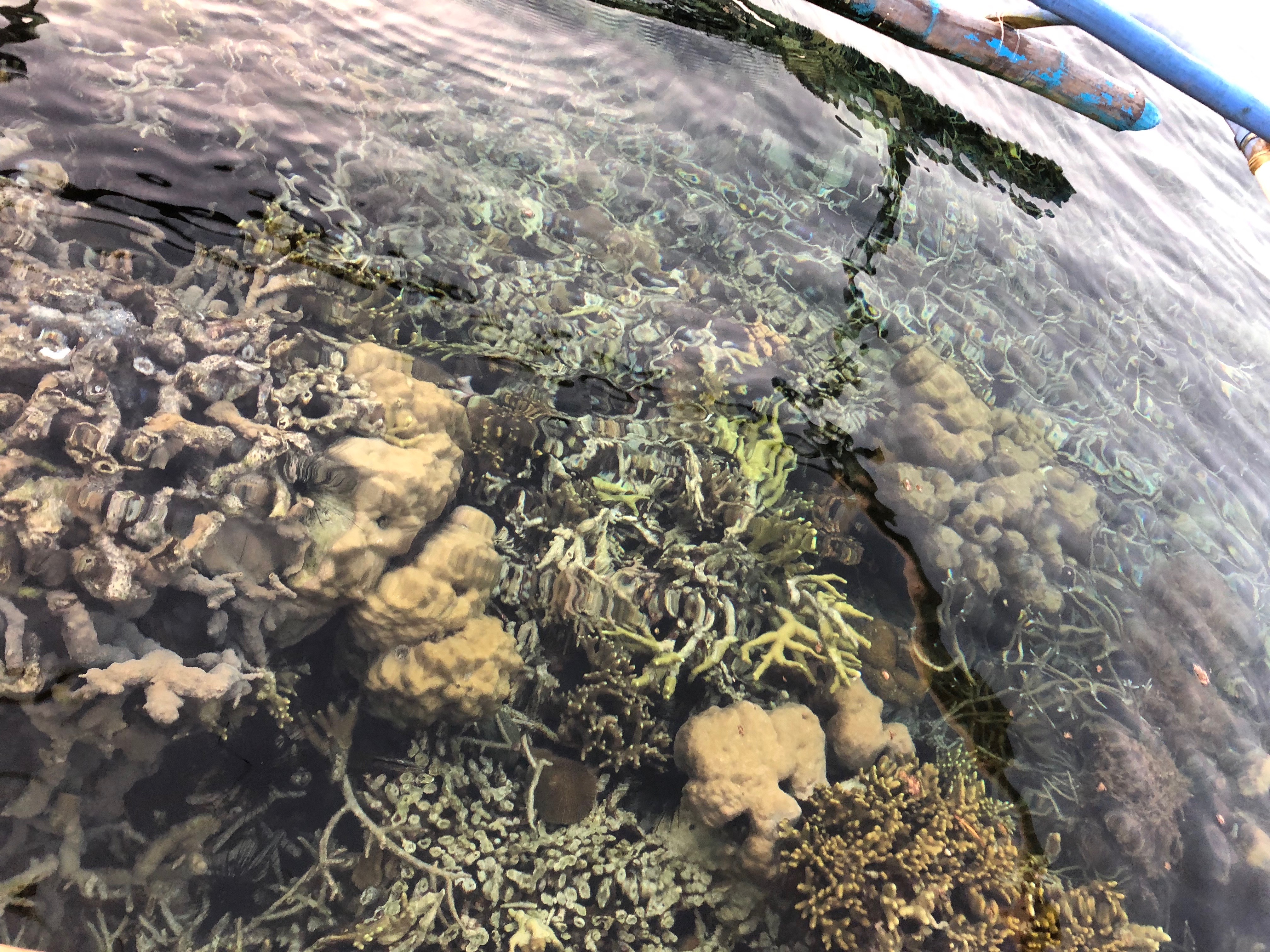
ブスアンガの澄んだ海とサンゴ礁
そして、このような海には私たちの研究対象である海草藻場やサンゴ礁が広がっています。私たちはこれらの画像データを分析し、植生モニタリングなど、沿岸海洋生態系に関わる様々な情報をリモートセンシングによって得る技術を研究しています。
今回の調査ではそんなリモセンによる解析結果と実際の生態系との相関を調べたり、生態系の統合モデリングに必要な流速などのデータを測ったりしました。下の写真は海草の分布を調べるためのトランセクトを設置している様子です。
Seagrass Surveyのためのトランセクトを設置。ウミショウブやホンダワラなどの海草藻類が見られます。
また、ドローンの操作をAyinさんから教わって上空から海の写真を撮ったり、海の濁度(どのくらい濁っているかの指標)の鉛直分布を測ったりもしました。
調査地の記録にはフィリピン大学でリモセンのスペシャリストである広瀬先生から教わった、スマホのGPSを使う方法が大活躍しました!調査中の天気も比較的良く、Mikkoさんや現地の人々にも助けられたおかげで、無事に大方の調査項目を終えることができました。フィリピン大学の学生も、ブスアンガの人々も、みなさん気さくで温かくて、フィリピンには日本と違って感情の豊かな人がたくさんいるなぁと思いました(笑)
ちなみに、私はまだ研究室1年目なので現地調査は初めてでしたが、これは私にとって初めての海外経験でもありました。ブスアンガの宿はネットワークもほとんど無いような辺境の地でしたが、朝はニワトリに起こされ、昼は海に潜って、夜は満天の星空を眺めて、とても健康的な生活でした(笑)
英語(とタガログ語)だけの環境でうまくいかないこともたくさんあり疲れましたが、大自然や異文化に触れられてとても楽しく、貴重で有意義な時間を送れたと思います。