In September 2025, ten members from Nakamura Lab went to Ishigaki Island for a field survey. What was originally planned as a standard data collection trip quickly turned into a much more unpredictable experience, with three typhoons passing through during our stay. The weather shifted constantly between heavy rain, strong winds, and short calm windows, forcing us to adjust plans almost every day.
Still, fieldwork continued wherever and whenever it was possible—across mangroves, rivers, wells, bridges, residential areas, and coastal zones. Some days ended up stretching late into the night, and sometimes decisions were made only minutes before heading out. Through all of this, one thing stayed consistent: everyone naturally stepped in to help wherever it was needed, regardless of individual projects.
Below are reflections from each member, written in their own way, sharing what they experienced during the trip.
Armando Benavidez – Building a Floating Multi-sensor System
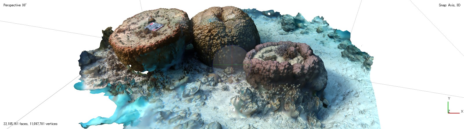
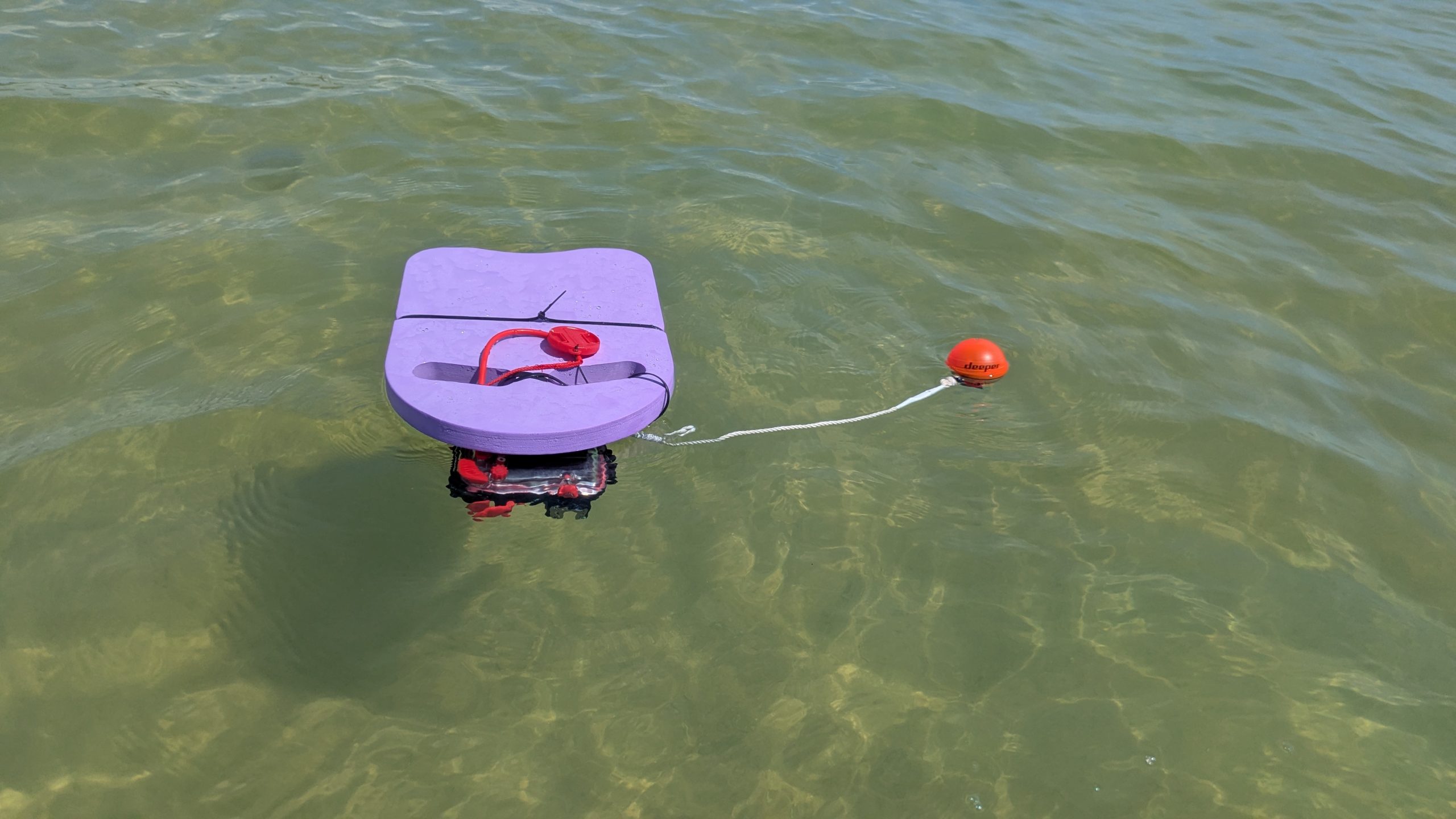
For me, this trip became less about a finished system and more about constant rebuilding in real conditions. The goal was to capture large-scale coral colony data using a floating platform, but the reality in the field forced many redesigns along the way.
The setup ended up combining a camera, a phone for GPS display, another phone for sonar logging, and a sonar sensor attached to the structure. Nothing really worked perfectly at first. Each deployment revealed a new issue—unstable mounting, syncing problems, or just the difficulty of handling everything in moving water.
But slowly, with help from senior lab members and others who stepped in without hesitation, the system became stable enough to produce usable synchronized datasets. Looking back, what made it work wasn’t just the design itself, but how many people were willing to jump in and help fix things on the spot.
Maki – 24-Hour Water Sampling in Shiraho Reef
The 24-hour sampling at Shiraho Reef was one of the most intense parts of the trip. We worked in shifts, rotating through day and night so that the measurements never stopped.
Every few hours, we collected water samples and checked logger data for temperature, depth, pH, light intensity, dissolved oxygen, nutrients, and isotope signals. Over time, the dataset started to feel like a continuous “story” of the reef environment changing through a full day cycle.
When combined with older data, the purpose becomes clearer—trying to understand how seagrass decline, influenced by sea turtle grazing, is affecting the surrounding marine system. It was tiring, but in a strangely satisfying way, because the continuity of the data made every shift feel connected.
Terai – Quadrat Survey for Coral Validation
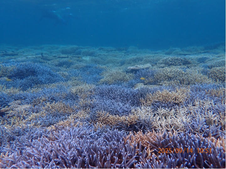
Most of my days were spent literally staring at the reef through a PVC frame.
We used the quadrat method to measure coral and algae coverage at different sites, mainly focusing on areas like Fukidō and Yoshihara where coral coverage is relatively high. Sometimes we also wandered a bit further, just searching for “good reef conditions” that would make the dataset more meaningful.
2025 was actually a relief in some sense—there was no large-scale bleaching event, so the reefs were still in a healthy state. That meant we could focus on collecting solid baseline data, which is exactly what we need for validating satellite-based analysis later on.
Uesugi – Collaborative Field Dynamics
There was a moment during a river survey when I realized how flexible everyone’s roles really were.
It started as one person’s project, but soon half the group was involved in some way—helping with measurements, holding equipment, or just making sure things ran smoothly. At the same time, a few people stayed slightly apart on the riverbank, resting, observing, or just enjoying a quiet break.
That contrast actually felt very typical of this trip: intense fieldwork happening in one corner, and calm, almost peaceful moments happening right next to it. Somehow, both were part of the same workflow.
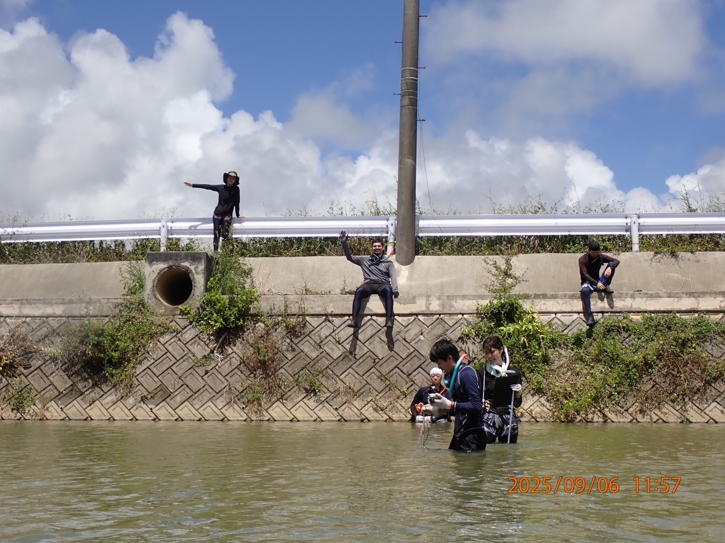
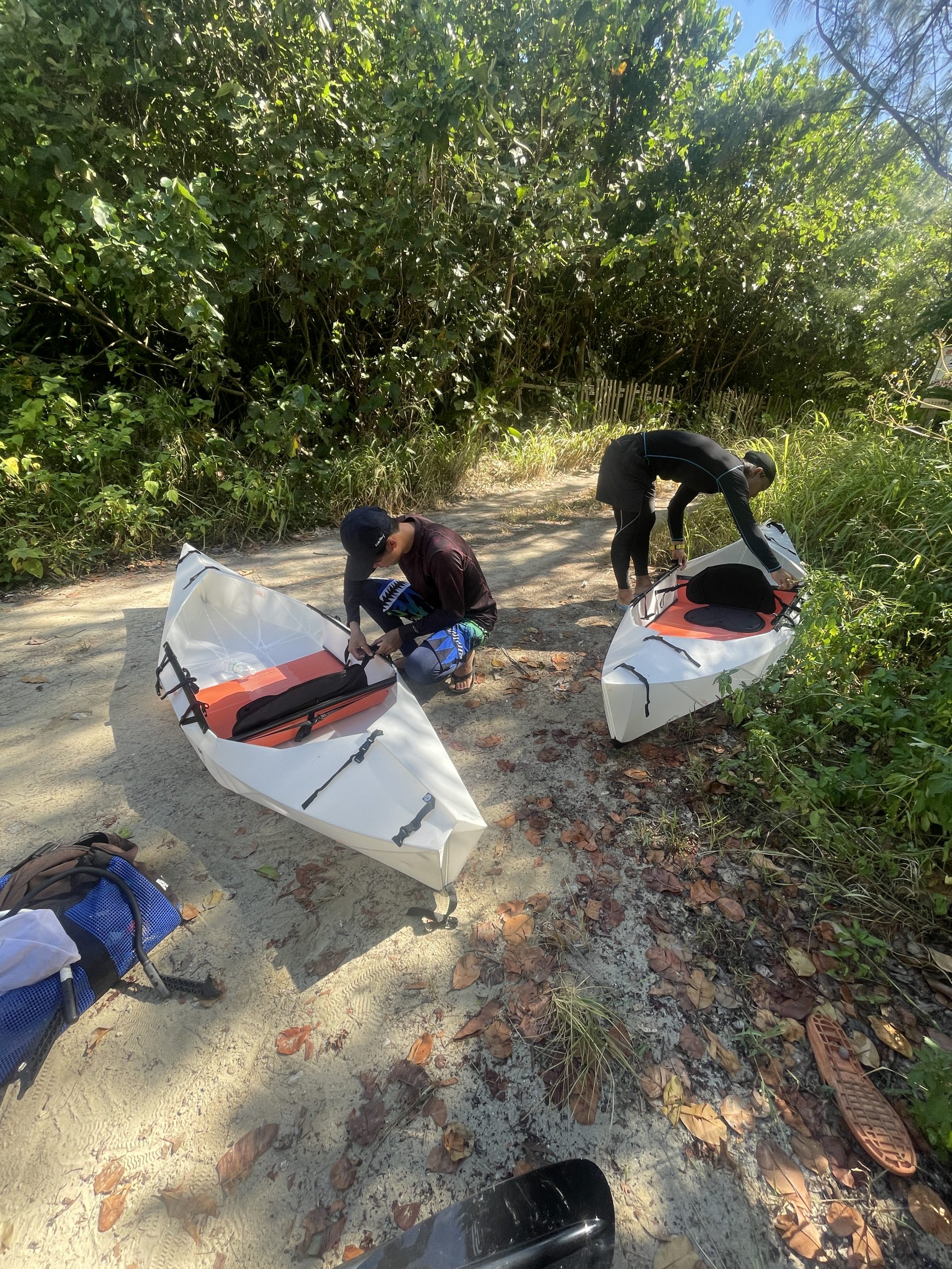
Dear – Water Quality Sampling and Kayak-Based Improvement
At the beginning of the trip, I struggled more than expected with water sampling quality. The main issue wasn’t the instruments—it was the environment. People swimming nearby kept disturbing the water, and that introduced a lot of human error into the data.
At some point, Nakamura Sensei brought in two kayaks, and honestly, that changed everything. Suddenly, we could access shallow areas properly, move equipment more efficiently, and most importantly, collect data without constant disturbance.
It also turned into something I didn’t expect at all—I ended up learning how to use a kayak properly during fieldwork. It was one of those small changes that ended up improving both the science and the experience at the same time.
Even with three typhoons and constantly changing conditions, the 2025 Ishigaki field survey turned into one of the most productive and memorable field campaigns of the year.
Each person had completely different goals and methods, but the trip worked because everything was interconnected through constant support and quick coordination in the field. In the end, it wasn’t just about the datasets we collected, but about how naturally the team adapted and worked together under real-world conditions.